
You are using an out of date browser. It may not display this or other websites correctly.
You should upgrade or use an alternative browser.
You should upgrade or use an alternative browser.
What is the weather like where you live? (2017)
- Thread starter Ash
- Start date
- Status
- Not open for further replies.
INSANE snowstorm currently! The city is shut down, the only thing that's open are classes. 

THE NATIONAL WEATHER SERVICE IN LINCOLN HAS ISSUED A BLIZZARD
WARNING...WHICH IS IN EFFECT UNTIL 9 PM CST THIS EVENING. THE
WINTER STORM WARNING IS NO LONGER IN EFFECT.
* TIMING...SNOW WILL CONTINUE ACROSS THE AREA THIS MORNING...OR
WILL QUICKLY DEVELOP WHERE IT HAS NOT ALREADY DONE SO. THE SNOW
WILL BEGIN TO TAPER OFF LATE THIS AFTERNOON OR EARLY THIS
EVENING.
* WINDS/VISIBILITY...NORTH TO NORTHEAST WINDS OF 25 TO 35
MPH...WITH GUSTS TO 45 OR 50 MPH WILL COMBINE WITH THE SNOW TO
PRODUCE NEAR WHITEOUT CONDITIONS AT TIMES. THE WINDS WILL ALSO
CAUSE TRAVEL DIFFICULTIES FOR HIGH PROFILE VEHICLES...ESPECIALLY
ON WEST TO EAST ORIENTED ROADWAYS.
* SNOW ACCUMULATIONS...6 TO 9 INCHES OF SNOW ARE EXPECTED ACROSS
THE AREA WITH LOCALLY HIGHER AMOUNTS POSSIBLE.
* MAIN IMPACT...WIND DRIVEN WET SNOW WILL PRODUCE NEAR WHITEOUT
CONDTIONS AT TIMES. TRAVEL WILL BECOME EXTREMELY HAZARDOUS AND
SHOULD BE AVOIDED IF POSSIBLE.
* OTHER IMPACTS...THE HEAVY SNOW WILL ALSO PRODUCE SNOW COVERED
ROADS. CAUTION SHOULD BE EXERCISED WHEN SHOVELING WET HEAVY
SNOW.
PRECAUTIONARY/PREPAREDNESS ACTIONS...
A BLIZZARD WARNING MEANS SEVERE WINTER WEATHER CONDITIONS ARE
EXPECTED OR OCCURRING. FALLING AND BLOWING SNOW WITH STRONG WINDS
AND POOR VISIBILITIES ARE LIKELY. THIS WILL LEAD TO WHITEOUT
CONDITIONS...MAKING TRAVEL EXTREMELY DANGEROUS. DO NOT TRAVEL. IF
YOU MUST TRAVEL...HAVE A WINTER SURVIVAL KIT WITH YOU. IF YOU GET
STRANDED...STAY WITH YOUR VEHICLE.
- Messages
- 437
- Highlights
- 0
- Reaction score
- 23
- Points
- 364
- Location
- Bergen, Norway
- Peak Coin
- 0.000000¢
- DB Transfer
- 0.000000¢
I thought I saw spring coming yesterday, but then I woke up to snow this morning.
- Messages
- 411
- Highlights
- 0
- Reaction score
- 0
- Points
- 0
- Location
- New Jersey
- Peak Coin
- 0.000000¢
- DB Transfer
- 0.000000¢
It's raining, it's pouring...then the sun comes out for two seconds and the rain starts again.
Also my old man isn't snoring this time. :D
Also my old man isn't snoring this time. :D
Been a hell of a night. Three tornados almost hit us. One of the cities over received heavy damage and towns South of us had fatalities. We're on our sixth or seventh tornado warning and there's no end in sight. I'm so over the weather.
Seraph said:A tornado just narrowly missed the house. Scary as ****. There's a second coming towards us and more dangereous storms behind that.
Seraph said:Been a hell of a night. Three tornados almost hit us. One of the cities over received heavy damage and towns South of us had fatalities. We're on our sixth or seventh tornado warning and there's no end in sight. I'm so over the weather.
That is insane. Please be safe!
- Messages
- 411
- Highlights
- 0
- Reaction score
- 0
- Points
- 0
- Location
- New Jersey
- Peak Coin
- 0.000000¢
- DB Transfer
- 0.000000¢
The rain won't give. It's super hard and we have a thunderstorm warning and the snow sounds really rough and I HATE IT. <- the weather alarm keeps warning thunderstorms. I have a SEVERE thunder phobia. :D
- Messages
- 638
- Highlights
- 0
- Reaction score
- 7
- Points
- 324
- Location
- California
- Peak Coin
- 0.000000¢
- DB Transfer
- 0.000000¢
Wow, sounds like total war by nature in places that are not coastal California.
It's partly cloudy right now... I guess that's fine, and I appreciate the serenity.
It's partly cloudy right now... I guess that's fine, and I appreciate the serenity.
One city, two seasons (sorry for double post!):
[video=youtube]https://www.youtube.com/watch?v=ZjiB_MBBNY4[/video]
[video=youtube]https://www.youtube.com/watch?v=ZjiB_MBBNY4[/video]
[video=youtube]https://www.youtube.com/watch?v=n4A9o2iQubs[/video]
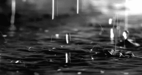
Right now:
- Messages
- 437
- Highlights
- 0
- Reaction score
- 23
- Points
- 364
- Location
- Bergen, Norway
- Peak Coin
- 0.000000¢
- DB Transfer
- 0.000000¢
Sunny and kind of warm! I don't believe it!
- Messages
- 437
- Highlights
- 0
- Reaction score
- 23
- Points
- 364
- Location
- Bergen, Norway
- Peak Coin
- 0.000000¢
- DB Transfer
- 0.000000¢
Cloudy and foggy today, but it's going to be sunny all next week!
- Status
- Not open for further replies.